

Suidhe Bhlain [St Blane's Hill]
Good walks are even better shared.
NS0952 : Wood fringing St Blane's Hill
Alan Reid Photo source
Overview
Suidhe Bhlain [St Blane's Hill]
Suidhe Bhlain is a delightful Marilyn that stands tall at 210 meters, offering a moderate challenge for hikers. Known for its stunning views and rich history, this hill is a hidden gem in the Argyle and Bute region of Scotland.
Geology
The hill's underlying geology primarily consists of granite and schist, remnants of an ancient landscape shaped over millennia. As you trek through the rocky paths, take a moment to appreciate the unique geological formations that tell a tale of glacial activity.
Routes
St Blane's Road Route
Starting from St Blane's Church, this path not only provides an enjoyable walk but also is steeped in history. The route is approximately 4.5 km long and typically takes around two hours to summit. Expect some delightful scenery as you rise through the woodland.
Summit Features
Upon reaching the summit, you’ll find a modest yet stalwart cairn, eagerly waiting to document your hike on camera. The panoramic views offer a scenic feast, perfect for those looking to capture the essence of Scotland's beauty.
Terrain Type
The terrain is predominantly grassy interspersed with rocky areas. Keep an eye out for some delightful boggy patches, a true hallmark of the Scottish landscape.
Views
The highlight of hiking Suidhe Bhlain is undoubtedly the views. From the summit, gaze across the Firth of Clyde to take in the breathtaking sight of the Isle of Bute and the expansive hills of Cowal. The best time for these views? Spring or early summer! Not only is it clear but you're also greeted by a symphony of colours as nature wakes up.
Hazards
While the hike is quite feasible, particularly if the weather is on your side, do watch for slippery stones and muddy areas, especially right after a rain shower. Arm yourself with a good pair of hiking boots and always check local forecasts before heading out.
Nearby Summits
For those looking to make a day of it, nearby summits such as Dunoon Hill and Knockdown provide additional challenges and further exploration opportunities.
Access
You can park conveniently at St Blane's Church, just off the A880. If you're relying on public transport, fret not! Bus services from Dunoon will get you close enough for a scenic stroll. The nearest town, Dunoon, is vibrant with cafes and shops ready to refuel you after your adventure.
Facilities
While there are no toilets or cafes on the hill itself, Dunoon is only a hop away, promising a good cup of tea and perhaps a cheeky cake.
History
The mountain’s name translates to 'the seat of Blane', indicative of its historical significance tied to Saint Blane, offering a glimpse into the rich tapestry of Scottish culture and history.
So lace up your hiking boots, make sure the camera is charged, and get ready for a fantastic day on Suidhe Bhlain! The views, the trails, and the friendly locals will surely make this hike one for the books.
Explore routes near Suidhe Bhlain [St Blane's Hill]
Walks starting near this hill. Open a route to check its map, distance and full itinerary.
Goatfell from Cladach
View route
Bishop’s Glen group walk
View route
West Bay walk and talk
View route
West Bay walk and talk
View route
Route planning notes
These notes describe possible approaches. Check a route's map and access information when planning your walk.
St Blane's Road Route
A popular footpath that begins at St Blane's Church leading up through scenic woodlands to the summit, perfect for both casual walkers and more experienced hikers.
Make a day of it, together
Find someone to share the walk with, or organise a day out along a route you like.
Photo Gallery
View all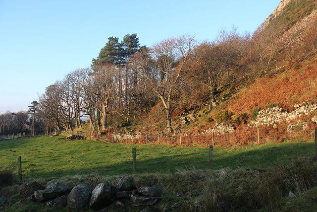 Photo could not load
NS0952 : Wood fringing St Blane's Hill
Alan Reid
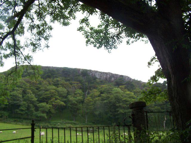 Photo could not load
NS0952 : Bute, St. Blane's Hill
william craig
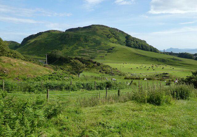 Photo could not load
NS0952 : Bute - Suidhe Bhlain or St Blane's Hill
Rob Farrow
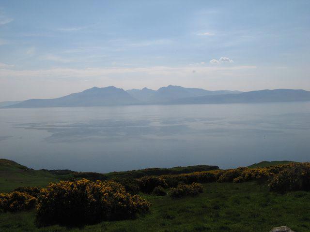 Photo could not load
NS0952 : View to Arran
Jonathan Wilkins
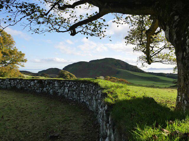 Photo could not load
NS0952 : View to St Blane's Hill from St Blane's Churchyard
James T M Towill
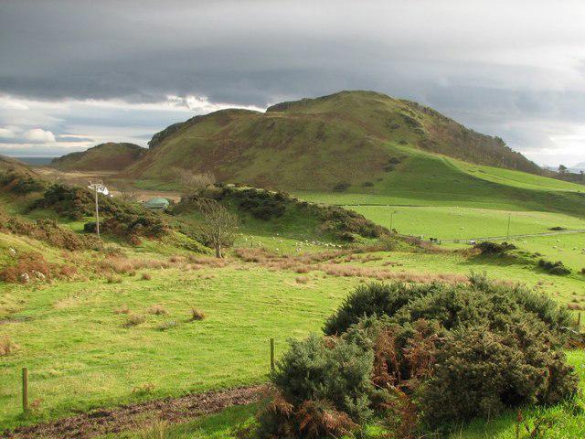 Photo could not load
NS0952 : Suidhe Bhlain
Callum Black
![NS0952 : Suidhe Bhlain [St Blane's Hill] Trig Point](https://cdn.walkmates.com/gallery-images/de983f33048e4d48b3ae867659db0a5c.jpg) Photo could not load
Photo could not load
NS0952 : Suidhe Bhlain [St Blane's Hill] Trig Point
Raibeart MacAoidh
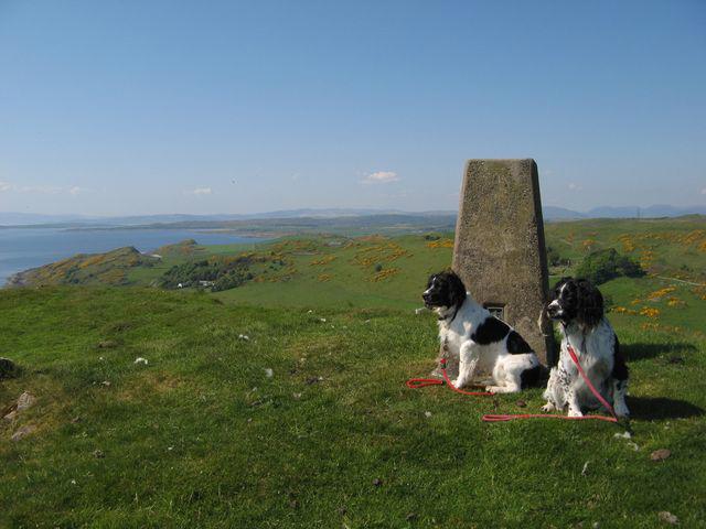 Photo could not load
NS0952 : St.Blane's Hill trig point
Jonathan Wilkins
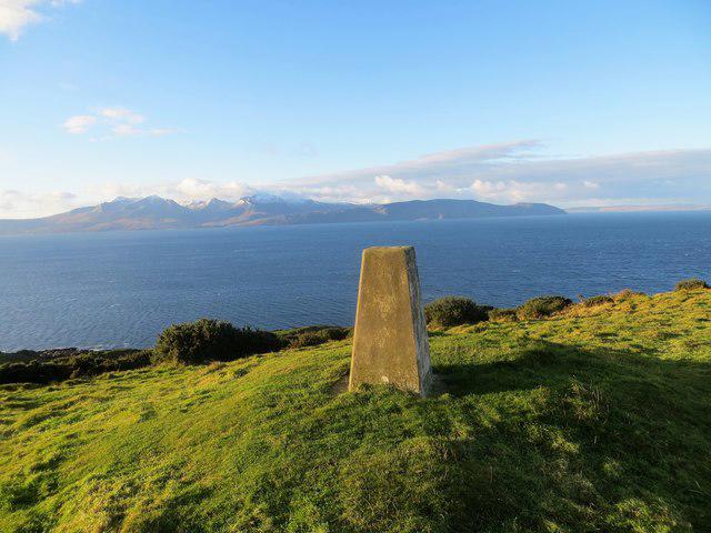 Photo could not load
NS0952 : Triangulation pillar on St Blane's Hill 123m
John Ferguson
Hill facts and local notes
Classifications
Elevation
123m
404 ft
Prominence
92m
Coordinates
55.7300, -5.0338
NS095526
OS Map
63 69
Explorer: 362S
At the Summit
The summit features a modest cairn and offers 360-degree views of the Firth of Clyde and the surrounding hills, making it a rewarding spot for photos or a well-deserved rest.
Terrain & Geology
Suidhe Bhlain is primarily composed of granite and schist, typical of the region, offering a glimpse into the geological history shaped by ancient glaciation and tectonic movements. The rocky outcrops provide an excellent foundation for a variety of flora.
Views & Scenery
From the summit, you can gaze upon the rolling hills of Cowal, the Isle of Bute, and the gorgeous expanse of the Firth of Clyde, where the seagulls might just judge your lunch choice.
History & Heritage
Name Origin
The name 'Suidhe Bhlain' translates to 'the seat of Blane', named after Saint Blane, a local martyr who is both revered and celebrated in the area.
Historical Significance
Historically, this site was sacred, with the nearby church serving as a pilgrimage stop for those seeking blessings from St Blane.
Getting There & Facilities
Parking
There is ample parking available at St Blane's Church, which serves as a great starting point for the hike, just off the A880.
Public Transport
Buses run from Dunoon to the vicinity, with a short walk from the nearest bus stop to St Blane's Church.
Nearby Facilities
While there are no facilities directly on the hill, Dunoon offers numerous cafes and shops where you can refuel post-hike.
Safety Information
Known Hazards
- Watch for slippery stones and muddy areas, particularly after rainfall. Sudden changes in weather can also occur, so being prepared is always a wise choice.
General Safety Tips
- Check weather conditions before setting out
- Carry appropriate clothing and equipment
- Let someone know your planned route
- Take a map, compass, and GPS device
- Carry emergency supplies: food, water, first aid kit, torch
Hills
Some common questions about the hills answered
Are there group walks up Suidhe Bhlain [St Blane's Hill]?
Many walkers use Walkmates to join or organise walks with others. You can check for group walks around Suidhe Bhlain [St Blane's Hill] through the maps
Are there other walkers around Suidhe Bhlain [St Blane's Hill]?
Activity varies by location and time, but Walkmates lets you see whether others have shared walks or shown interest in this area. Find other people through the walking friends search walking friends for Suidhe Bhlain [St Blane's Hill] search or of course create your own walk for Suidhe Bhlain [St Blane's Hill]
Can I organise a walk to Suidhe Bhlain [St Blane's Hill]?
Yes. If there aren’t any walks listed already, you can create a walk and make it available for others to join.
If you're signed up to Walkmates, you can create a walk to Suidhe Bhlain [St Blane's Hill].
How do I find a walk up this hill?
There are often multiple ways to walk this hill, depending on experience and route preference. Walkmates helps you explore walks and routes that others have shared.
Can I suggest a new route up Suidhe Bhlain [St Blane's Hill]?
Yes. You can suggest or create routes to share with others. Walkmates focuses on the social side of walking, so routes are used to help people organise walks and explore areas together, rather than as detailed navigation tools or route libraries.
Other uses really appreciate knowledgeable walkers sharing their routes. Share your favourite route to Suidhe Bhlain [St Blane's Hill] here
The is an error or something incorrect about this hill. How do I let you know?
We always strive to keep the information on Walkmates as accurate as possible. If you find an error, please let us know through the contact form and we'll aim to correct it as quickly as possible
Community Discussion
Comments
Location
![Suidhe Bhlain [St Blane's Hill] location map](https://cdn.walkmates.com/hill-maps/hill-sources/6994/55.73003_-5.03377.png)
Grid reference: NS095526
View on OpenStreetMapOpens a map in a new tab, centred on the hill.
Nearby Hills
Goatfell [Goat Fell]
875m
Cir Mhor
798m
Beinn Ghlas
420m
Ailsa Craig
339m
![The Cobbler [Ben Arthur]](https://cdn.walkmates.com/gallery-images/a1b697040769474a8338b3fb586ebc7a.jpg)
The Cobbler [Ben Arthur]
887m
No comments yet. Be the first.